3D Vision and Spatial AI

Estimate Depth to Understand Real-World Distances → Depth Estimation
Infer Depth from a Single Camera Input → Monocular Depth Estimation
Perceive Depth Using Dual-Camera Systems → Stereo Vision
Reconstruct 3D Structure from Motion Across Frames → Structure from Motion
Understand Geometry from Multiple Viewpoints → Multi-View Geometry
Rebuild Real-World Scenes in 3D Digitally → 3D Reconstruction
Capture Complete Volumes for Detailed Spatial Analysis → Volumetric Reconstruction
Detect Objects in 3D Space with Precision → 3D Object Detection
Estimate Accurate Body and Object Orientation in 3D → 3D Pose Estimation
Understand Complex Environments in Three Dimensions → 3D Scene Understanding
Process and Analyze Spatial Data from Point Clouds → Point Cloud Processing
Render Realistic Scenes Using Neural Representations → Neural Radiance Fields
Generate High-Fidelity 3D Scenes Efficiently → Gaussian Splatting
Enable Real-Time Localization and Mapping → SLAM
Track Camera Movement Through Environments → Visual Odometry
Create Detailed Maps of Physical Spaces → Spatial Mapping
Combine LiDAR and Camera Data for Better Perception → LiDAR-Camera Fusion
Integrate Multiple Sensors for Robust Spatial Awareness → Sensor Fusion for Spatial Perception
Understand and Analyze Object Shapes in 3D Space → Shape Analysis
Industrial Use Case
3D Vision and Spatial AI for Industrial Use Case
Transportation & Mobility
Depth estimation → Measure safe braking distance and collision gaps
3D object detection → Identify road obstacles, barriers, and dynamic hazards
Visual odometry → Track vehicle movement without GPS dependency
👉 Used for: Advanced driver assistance and autonomous navigation systems
Manufacturing and Mobility
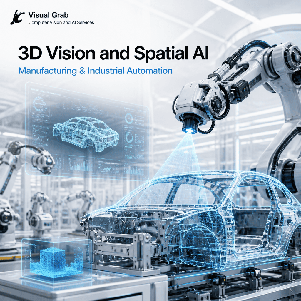
3D reconstruction → Digitize complex components for inspection and replication
Point cloud processing → Detect surface deviations and dimensional errors
3D pose estimation → Align parts accurately for robotic assembly
👉 Used for: High-precision manufacturing and automated production lines
Retail, Commerce and Logistics

3D scene understanding → Analyze in-store customer movement in physical space
Depth sensing → Estimate product stacking and shelf depth usage
Spatial mapping → Model warehouse layouts for optimized picking routes
👉 Used for: Space optimization and intelligent logistics planning
Healthcare & Life Sciences
Healthcare & Life Sciences

3D reconstruction → Generate patient-specific models for treatment planning
Depth estimation → Assist in minimally invasive procedures
Spatial mapping → Track instrument positioning during surgeries
👉 Used for: Personalized healthcare and surgical assistance systems
Agriculture & Environmental Monitoring
Agriculture & Environmental Monitoring
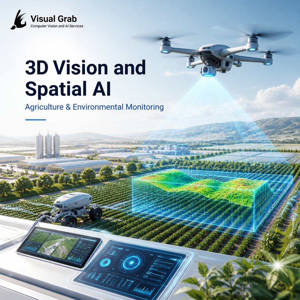
Depth estimation → Assess plant density and canopy structure
3D mapping → Model land contours for irrigation planning
Sensor fusion → Combine satellite, drone, and ground sensor data
👉 Used for: Farm optimization and environmental analysis
Infrastructure & Smart Cities

3D mapping → Create high-accuracy digital infrastructure models
LiDAR-camera fusion → Capture detailed road and building geometry
Spatial analysis → Monitor deformation in bridges and structures
👉 Used for: Predictive maintenance and urban infrastructure planning
Media, Sports & Entertainment

3D reconstruction → Build realistic digital doubles and environments
Volumetric capture → Enable immersive replay experiences
3D pose estimation → Capture athlete biomechanics in detail
👉 Used for: Next-gen content creation and performance analysis
Security, Defense & Public Safety
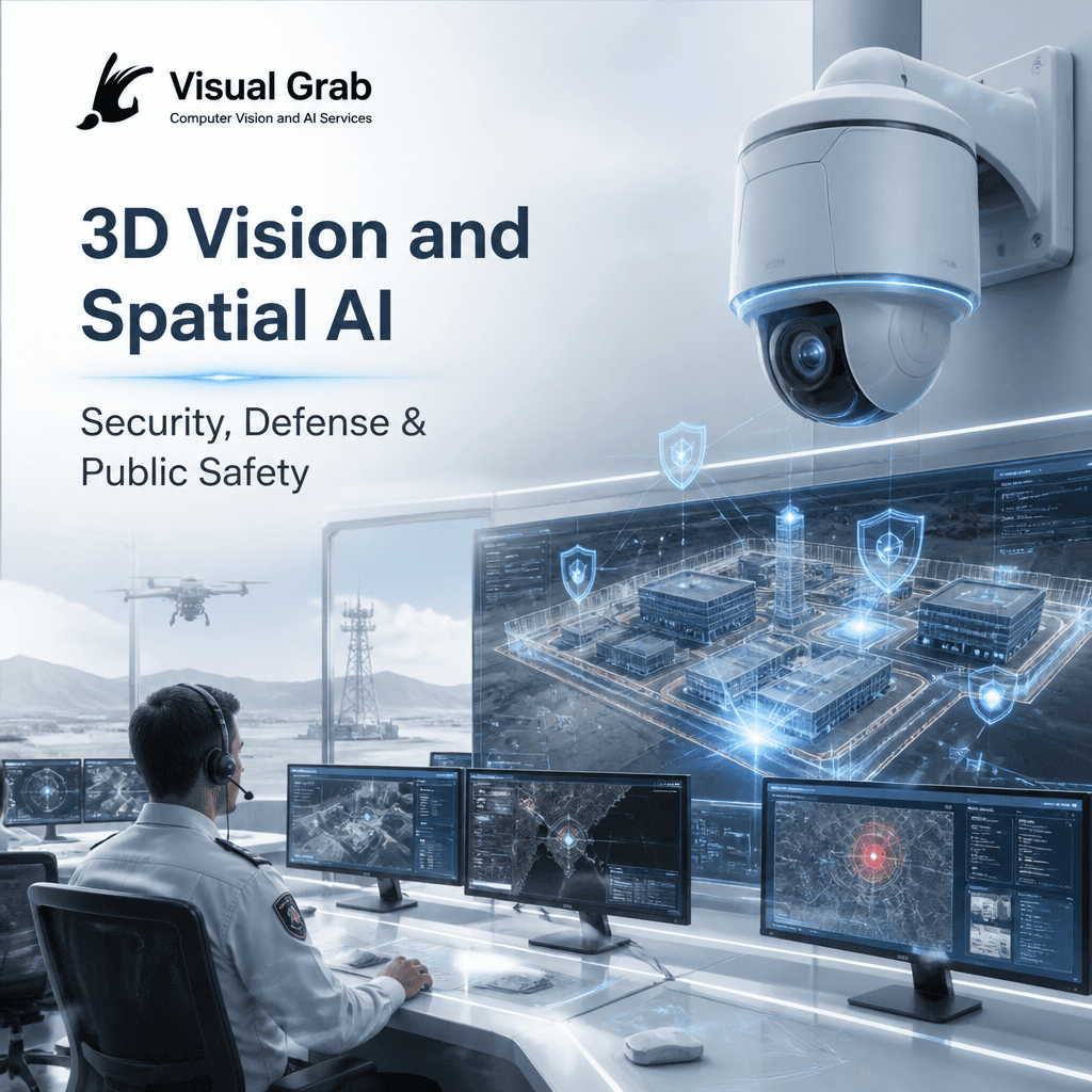
3D scene understanding → Analyze terrain and built environments for risks
Spatial mapping → Enable navigation in GPS-denied environments
Sensor fusion → Integrate multiple sensors for situational awareness
👉 Used for: Tactical planning and mission-critical operations
Robotics & Autonomous Systems

SLAM → Build and update maps in unknown environments
3D object detection → Recognize and locate objects for interaction
Spatial mapping → Enable robots to plan paths and avoid obstacles
👉 Used for: Intelligent robotics and autonomous system navigation
Turn 3D Vision & Spatial AI into Real-Time Business Decisions
Tell us your use case, and we’ll map how 3D Vision & Spatial AI can transform your operations—whether it’s depth sensing, spatial mapping, 3D tracking, or environment understanding.
What you’ll receive:
- A tailored 3D vision and spatial intelligence solution approach
- Relevant industrial use cases aligned to your domain
- Expected impact on precision, spatial awareness, and decision accuracy
👉 Get My 3D Vision Solution Blueprint
Used across robotics, autonomous systems, manufacturing, healthcare, infrastructure, and smart environments for spatial understanding, navigation, and intelligent automation.